Mobile mapping system
mobile laser scanning & photogrammetric system
About mobile mapping technology
Usually the system is made up of a GNSS receiver, an IMU (Inertial Measurement Unit), a Distance Measurement Instrument (scanners, cameras or these combinations), a Distance Measurement Instrument (DMI) on a mobile platform and softwares (which provide the aligned working of the subsystems, and the real-time and post-processing).
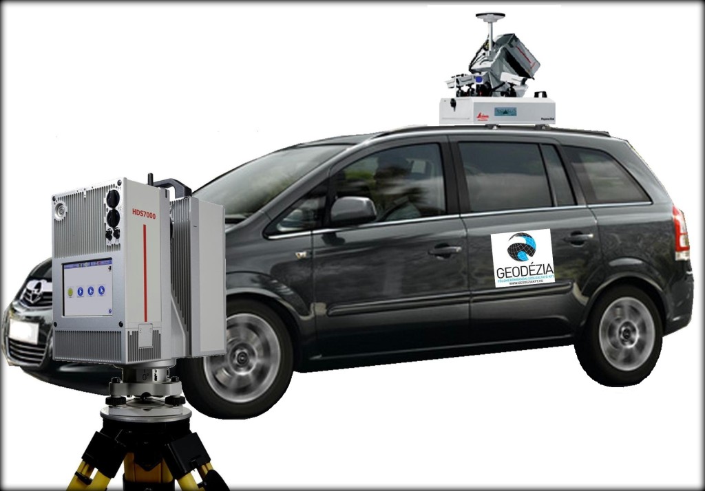
Mobile mapping system elements
Our mobile mapping system is a combination of digital photogrammetry and 3D laser scanning.
Main components of the system: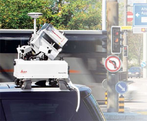
– high accuracy laser scanner
– camera system (6 CCD cameras)
– IMU
– GNSS receiver (NOVATEL)
– control and processing system (based on ESRI)
– transport vehicle
3D laser scanner
It was important for us that the scanner also can use alone for static measurements, as it can be separated from the system. Range accuracy at 50 m: 0.8mm/1.2 mm/2.7 mm (white/gray/black).
Camera system
The software is generate a spatial model from the pictures. So this is independent from the laser scanning. This model is a photogrammetric product and we are able to make maeasurements from it. The 6th camera can manage into the road, so it is possible to make examination of the pavement structures.
GNSS/IMU
These systems are responsible for the positioning. The IMU responsible for positioning until the GNSS losing the signal. The absolute accuracy is the accuracy of the GNSS/IMU systems. The surveying speed is 30-50 km/h in urban areas and 80-100 km/h in highways.
File extensions
Our system produce the pictures in JPEG extension and the 3D point cloud in LAS, TXT or PTS extensions. The system supports the standard of ASTM E57 for 3D systems. The processed files can be stored in different ESRI formats. The system also handles the CAD formats (DWG, DXF, etc.).
Data processing
After the data processing we make the evaluation with ArcGDS (improved for ESRI enviroment) or with different programmes. It depends on what the client want to. (1. picture)


1. picture: After the data processing we make the evaluation with ArcGDS (improved for ESRI enviroment) or with different programmes. It depends on what the client want to
 2.picture: editing in stereoscopic enviroment
Main applications
|
Highways and roads surveying
|
|
|
Urban areas
|
|
|
Railways,tramways
|
|
|
Architecture, monument protection
|
|
|
Other applications
|
|